
Boundaries Marked Before Construction Begins
Property Line Surveys in Hopedale for projects requiring documented boundary locations
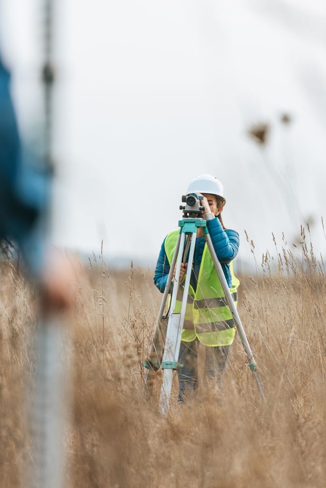
A. S. Elliott & Associates provides property line surveys in Hopedale that identify and document the exact location of legal boundaries. You need this service before installing fencing, planning additions, or resolving questions about where your property ends and a neighbor's begins. The survey establishes where improvements can be built without encroaching on adjacent parcels.
The process combines research of recorded deeds and plans with field investigation and precise measurement of physical markers. Boundary locations are verified through comparison of legal descriptions with monuments found on site, and any discrepancies are resolved through additional analysis. This work prevents construction errors that would require costly relocation of structures or legal disputes over placement.
Schedule a consultation to review your boundary documentation needs before beginning site work.
Our Services
What Proper Boundary Documentation Requires
Property line surveys begin with title research to obtain recorded deeds, subdivision plans, and prior survey records that establish legal descriptions. Field crews then locate physical evidence including iron pins, stone bounds, drill holes, and other monuments referenced in those documents, measuring distances and angles to confirm positions match the legal record. When monuments are missing or conflicting evidence appears, additional research and calculation are required to determine the most reliable boundary location based on available data.
After the survey is complete, you receive a plan showing boundary lines, monuments found or set, dimensions, adjoining property owners, and any encroachments or gaps discovered during the investigation. The documentation provides a legal record you can reference when obtaining building permits, negotiating easements, or transferring property. Municipalities and title companies rely on this information to verify that proposed work remains within your lot lines.
Residential applications include fence installations, garage additions, and driveway expansions, while commercial surveys support parking lot construction, building setbacks, and lease boundary verification. The survey also identifies utility easements and right-of-way restrictions that affect where you can place structures. A. S. Elliott & Associates handles both residential and commercial property line surveys with the same attention to research and measurement accuracy.
Common Questions About This Service
Property owners in Hopedale often ask about the boundary survey process before starting projects that require precise property limits.
What happens if original boundary markers are missing?
The surveyor uses measurements from nearby found monuments and recorded dimensions to calculate where missing markers should be located, then sets new monuments at those positions and documents the basis for placement on the final plan.
How does the survey resolve disputes with neighbors about boundary location?
The survey provides an objective analysis based on legal records and physical evidence, showing where the boundary falls according to deed descriptions and recorded plans rather than assumptions based on fence lines or mowing patterns.
When should the survey be completed relative to construction scheduling?
Property line surveys should be finished before design work begins so architects and engineers can position structures with accurate setback dimensions, preventing plan revisions after permits are submitted.
What documentation do you need to begin the survey?
The surveyor needs your property address and deed reference information, which allows retrieval of recorded plans and title documents from the registry of deeds before fieldwork starts.
How long does fieldwork take for a typical residential lot?
Field investigation for a standard residential property usually requires several hours to locate monuments, measure boundary lines, and document site conditions, though complex parcels with extensive frontage or difficult terrain take longer.
A. S. Elliott & Associates delivers clear boundary documentation that supports confident project planning and property transfers. Request a consultation to discuss your specific survey requirements and timeline for project completion.