
Documentation That Matches Field Conditions
As Built Surveys in Worcester for projects requiring accurate records of completed construction
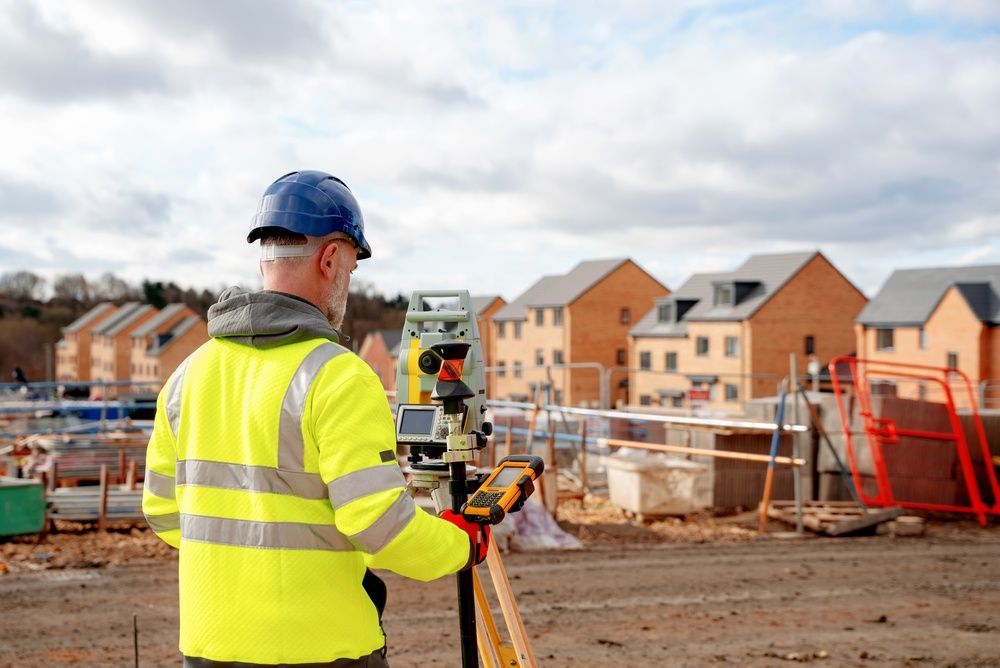
Construction never follows design plans exactly, and as built surveys document what was actually installed rather than what was originally proposed. A. S. Elliott & Associates measures completed site improvements, structures, utilities, and grading to create records that reflect real-world conditions in Worcester. These surveys support project closeout, permit compliance verification, and future maintenance planning by providing measurements taken from finished work rather than design drawings.
Field crews measure the locations and elevations of constructed features including building corners, pavement edges, utility manholes, drainage structures, and landscaping elements. The data is compared to approved design plans to identify deviations that occurred during construction, and those differences are documented on final deliverables. Municipalities require this information to verify that permitted work was completed as approved before issuing certificates of occupancy.
Request a project inquiry to discuss documentation requirements for your completed construction.
Our Services
What Changes After Construction Documentation Completes
As built surveys capture the precise locations of underground utilities, pavement thicknesses, structure dimensions, and grading slopes after construction equipment leaves the site. This information becomes the baseline for future renovations, expansions, or repairs because it shows what exists rather than what was planned. Contractors bidding on additions or utility work use as built plans to understand existing conditions without exploratory excavation.
You receive scaled drawings showing measured positions of all constructed features, elevation data for drainage analysis, and notes describing materials or conditions observed during fieldwork. The documentation allows facility managers to locate buried infrastructure during maintenance, engineers to design expansions that tie into existing systems correctly, and owners to demonstrate compliance with zoning setbacks or easement restrictions. Commercial and municipal projects rely on this record keeping for asset management and long-term planning.
The survey identifies discrepancies between design intent and constructed reality, such as utility lines installed at different depths than shown on plans or structures positioned several feet from approved locations. Private projects benefit from the same detailed record keeping, particularly when properties change ownership or undergo phased development. Accurate as built documentation prevents costly conflicts when future work assumes design plans reflect actual conditions.
Answers to Frequent Service Questions
Clients with completed construction projects often ask about the documentation process and deliverables provided after fieldwork.
What measurements are included in as built survey deliverables?
The survey documents horizontal positions, elevations, dimensions, materials observed, and relationships to property boundaries for all constructed features including buildings, paving, utilities, retaining walls, and site amenities.
How soon after construction should the as built survey be completed?
Field measurements should occur immediately after construction finishes and before landscaping or other work obscures access to features like utility trenches, foundation details, or grading transitions that need documentation.
What format do you provide for the final as built plans?
Deliverables typically include scaled CAD drawings, PDF plans with dimension annotations, and coordinate data files compatible with engineering software used for future design work or municipal record systems in Worcester.
Why do municipalities require as built surveys for permit closeout?
Building departments and planning boards need verification that constructed improvements match approved permits, remain within property lines, and meet zoning requirements before releasing bonds or issuing occupancy certificates.
How does the as built survey support future renovations or expansions?
Designers and contractors use the measured data to position new work relative to existing structures, connect to installed utilities at documented depths and locations, and evaluate site constraints without guessing about current conditions.
A. S. Elliott & Associates provides detailed as built documentation for commercial, municipal, and private projects that require accurate records for closeout and future reference. Contact our office to schedule fieldwork following your construction completion.